Tag Archives: Science Tech Tablet

Reflections From A Future Hawaii: Can A Tropical Paradise Become A Portal To Deep Space?

28 Feb

Honolulu, Hawaii 2054: Launch gateway to L4 & L5 space stations, Tranquility Moon Base and the Mars Frontier.

Honolulu, Hawaii 2054: Launch gateway to L4 & L5 space stations, L2 Lunar Hub and the Mars Frontier. Illuminated aircraft and monorail tubes bring early commuters into the City as twilight transitions to dawn. 

Multimedia essay by: David Johanson Vasquez © All  Rights

Waikiki, on Hawaii’s Island of Oahu is a Cross Roads of the World. The allure of this tropical city attracts millions of vacationing pilgrims from across the globe. Steady infusion of foreign and domestic investment creates a dynamic and often futuristic looking metropolis.

Digital display at the Galleria.

Digital display at the Galleria.

  On my last visit to Waikiki in November, I came across an ultramodern, duty-free, fashion and clothing store  located on its main boulevard. Entering this multiplex shopping site felt like being on the sci-fi movie sets for Spielberg’s Minority Report or  Ridely Scott’s Blade Runner. My son-in-law commented as he left the “Galleria” — “it was a sensory overload experience,” and headed back to the hotel to sleep it off. Hawa_Futr_BPP_121116_a38 . .

Portal entry to Waikiki's Galleria.

A hall portal entry to Waikiki’s Galleria.

Entering the Galleria is exciting and dynamic for those who are ready  for a hyper-sensory encounter while shopping for fashion and cosmetics products.

Honolulu’s Dynamic Style of Architecture

Honolulu encompasses Waikiki and has a rich, vibrant range of architectural styles, including its own unique “Hawaiian Architectural Style. Within Waikiki, the new architecture blends modern and Japanese style. 

Modern Hawaiian architectural style.

Modern Hawaiian architectural style.

Honolulu skyline with natural vegetation in foreground.

Honolulu skyline with natural vegetation in foreground.

From our condo balcony we could see a night panorama of Honolulu, which inspired  this essay’s theme of — a reflections from a future Hawaii. 

Waikiki_Pano_BPP_ewp_44

.      

Massive walls of electronic  projection frame the entry environment in Waikiki's Galleria.

Massive walls of electronic projection frame the entry environment in Waikiki’s Galleria.

The Sky Is No Longer The Limit For Digital Displays

Contemporary marketing and advertising have embraced electronics LED’s to capture our attention and stimulate our senses. We can expect the future will sustain sensory overload for the marketing of products, services and ideas on a global scale.     


Multimedia environments are more common in the 21st Century. As natural environments are increasingly altered or replaced by new ones, projections of “paradise lost” will attempt to fill an expanding void.

Honolulu skyline with natural vegetation in foreground.

Honolulu panorama

.

.

A Scenario For Things To Come

Advances in artificial intelligence [AI] and remote-control technology continues expanding its role in automating transportation industries. Seamless, point-A-to-point-B travel provided by auto pilot features in ground and air transportation standard— World travel  becomes even more assessable and affordable. 

A futuristic Boeing pilotless passenger jet with personal projection systems ( PPS).

A futuristic Boeing pilotless passenger jet with personal projection systems ( PPS).

Both Work and play  amenities can be extended to just about any  cabin environment for an enhanced travel experience.

i

South Point (Ka Lae) – Naalehu, Big Island, Hawaii +18° 54′ 39.96″, -155° 40′ 52.00″ “The Pan Pacific Launch Site” — Gateway To Lunar And Deep Space Exploration

↑As international space exploration matures, greater consortiums and partnerships develop between countries and corporations to create  space operations staging points near Earth’s orbit.

NASA Illustration of Lagrange Ponts of Earth-Sun System (not proportion to scale)

NASA Illustration of Lagrange Ponts of Earth-Sun System (not proportioned to scale)

The Lagrangian Points: of L2, L4 and L5 are  locations relatively close to Earth, which provide stable orbits for building hubs to assist in lunar, deep-space and asteroid exploratory missions. 


Photo courtesy of NASA.

Photo courtesy of NASA.

The Big Island of Hawaii's South Point ( Ka Lae) is in the neighborhood of 1,400 miles from the  Equator,  which requires less fuel for launching rockets into orbit.

The Big Island of Hawaii’s South Point ( Ka Lae) is in the neighborhood of 1,400 miles from the Equator, which requires less fuel for launching rockets into orbit.  On the right, a SpaceX rocket has lifted off from the Pan Pacific Launch Site, on its journey to an international L2 Lunar Hub – Photo illustration: David Johanson Vasquez © 

Rocket view looking back towards Hawaii's Pan Pacific Launch Site.

Space view looking back towards Hawaii’s Pan Pacific Launch Site. Photo by: David Johanson Vasquez ©

Locations of previous NASA Apollo Manned landing sites. Photo illustration courtesy of NASA.

Locations of previous NASA Apollo Manned landing sites. Photo illustration courtesy of NASA.

Section view of International L2 Lunar Hub in stable platform orbit. Prime contracting consortium: Boeing, Mitsubishi HI, AviChina, Hindustan Aeronautics and ST Engineering.  — Photo illustration: David Johanson Vasquez ©

Section view of International L2 Lunar Hub in stable platform orbit. Prime contracting consortium: Boeing, Mitsubishi HI, AviChina, Hindustan Aeronautics and ST Engineering. — Photo illustration: David Johanson Vasquez ©

"Asteroid 1" - artist concept of asteroid mining mission to an Earth approaching asteroid.NASA sponsored a study on space manufacturing held at Ames Research Center (ARC) June1977, commissioned painting by - Denise Watt.

Asteroid 1″ – artist concept of asteroid mining mission to an Earth approaching asteroid.
NASA sponsored a study on space manufacturing held at Ames Research Center (ARC) June 1977, commissioned painting by – Denise Watt.

Digital post cards from the Martian Frontier.— Photo illustration: David Johanson Vasquez ©

Digital post cards from the Martian Frontier.
— Photo illustration: David Johanson Vasquez ©

Digital post cards from Mars - mining operations on the "Red Planet."  — Photo illustration: David Johanson Vasquez © All Rights.

Digital post cards from the Martian Frontier – mining operations during a “Red Planet”sunset. — Photo illustration: David Johanson Vasquez © All Rights.

Links & Resources:

http://www.hawaii.edu/news/article.php?aId=4926

University of Hawaii Manoa Small-Satellite Program Selected for NASA launch

.

http://www.universityofhawaiiinnovation.com/features/readying-for-liftoff/

University of Hawaii innovation article about UH College of Engineering Satellite Program –  by: Jolyn Okimoto Rosa


http://www.youtube.com/watch?v=dHdNSS85c5M

↑    ↑    ↑    ↑

Please view this window into the future, with a marvelous video of a low Earth orbit (LEO). Watch in full view mode, with the volume turned up.

.

.

[contact-form][contact-field </a></p> href="https://sciencetechtablet.files.wordpress.com/2013/02/futr_hawa_jet_bpp_121118_e28.jpg">label=’Name’ type="’name’" required="’1’"/] [contact-field label="Email" type="email" class="GINGER_SOFATWARE_correct">/][contact-field label="Website" class="GINGER_SOFATWARE_correct">/][contact-field label="Comment" type="textarea" class="GINGER_SOFATWARE_correct">/][/contact-form]

The Latest Full Throttle Multimedia Video of Seattle From the R22 Beta Helicopter – Part 2 of 2

29 Nov

Multimedia video essay by: David Johanson Vasquez – © All Rights

BigPictureOne & ScienceTechTablet are dedicated sites for including excitement, experience & education in E-learning. For an alternative graphic format of this multimedia essay please visit: bigpictureone | Using photos, video & words to explore the Big Picture WordPress.com site

Have you ever traveled by helicopter and encountered a full-throttle-ride at a tree top-level? Part 2 of my Helicopter video series is now online for you to experience. There are valuable safety tips, aerial photo techniques, employment requirements for helicopter mechanics  as well as the ultimate joyriding aerial views of Boeing Field and Seattle!

Collaboration and Clear Communication

Clear communication and teamwork between helicopter pilots and flight mechanics is essential for aviation safety. Professional collaboration and working experience are also required between a pilot and photographer for ensuring successful photographic results. On the day of this video was shot our helicopter experienced technical issues, which needed repairs before completing the Port of Seattle’s aerial photo shoot. With solid communication between pilot and ground crews established, the repairs were completed as the fast and furious activity of aircraft went on all around us at one of the nation’s busiest international airports.

Video by: David Johanson –  © All Rights

Helicopter Rear Rotor Blades Can Be a Liability

A February 2007 Rotor & Wing Magazine article by Tim McAdams, used two tragic crash events involving helicopter aerial photography to illustrate potential hazards encountered from the helicopter’s rear rotor. In the article it reported, “the NTSB determined the probable cause as the pilot-in-command’s improper in-flight decision to maneuver at a low airspeed with a left quartering tailwind, which resulted in a loss of tail-rotor effectiveness.”  The investigation of these and similar crashes helped to create the FAA Advisory Circular AC90-9, that warns pilots of conditions which can cause loss of flight stability due to stress on rear rotors.

Under no circumstances should anyone including ground crews be near the helicopter’s rear rotor while the engine is on. The video shows why helicopter rotor blades are painted with bright patterns to warn of their potential danger.

Fast and Furious

Helicopter operations are virtually never boring and are the centers of major activity. See how the latest video in the series explores Seattle’s dynamic landscape, Boeing Field operations and helicopter safety.


REFERENCES: (Click on these sites to learn more on the subject)

Safety Around Helicopters

http://www.fs.fed.us/fire/av_safety/promotion/safety_alerts/IA%20SA%2011-03%20LTE%20Final.pdf

Rotor Hazards

Helicopter Hazards | Aeronautical Knowledge Handbook

Helicopter Landing Area Safety

Rotor & Wing Magazine :: Safety Watch: Loss of Tail Rotor Effectiveness

Tail rotor – Wikipedia, the free encyclopedia

The Kopp-Etchells Effect: Eerie Halo of a Helicopter’s Rotor Blades in a Dust Cloud – Neatorama

http://www.dtic.mil/cgi-bin/GetTRDoc?AD=AD0282087

The Spokesman-Review – Google News Archive Search

Robinson Helicopter Co.

Helicopters Northwest – Boeing Field

Intersting facts about the historic Smith Tower

HistoryLink.org- the Free Online Encyclopedia of Washington State History

Smith Tower – Wikipedia, the free encyclopedia

Walking Tours (Self-Guided) – Visiting Seattle – Seattle.gov

http://www.soundtransit.org/Documents/pdf/about/Chronology.pdf

Downtown (Central Business District) guide, moving to Seattle | StreetAdvisor

Columbia Helicopters

CH-47JA Helicopter | Helicopters | Kawasaki Heavy Industries, Ltd. Aerospace Company

Boeing CH-47 Chinook

Boeing: History — Products – Boeing CH-47 Chinook Rotorcraft

MD Helicopters MD 500 – Wikipedia, the free encyclopedia

Boeing: History — Products – Hughes OH-6 Cayuse/500 Military and Civilian Helicopter

Helicopter Safety | Flight Safety Foundation

http://drum.lib.umd.edu/bitstream/1903/1900/1/umi-umd-1880.pdf

King County International Airport/Boeing Field

Port of Seattle


Blinded By Light, In The Middle Of Night

16 Aug
Multimedia essay by: David Johanson Vasquez © All Rights  — Second Edition
For an alternative formatted view of this essay, please visit — http://www.BigPictureOne.wordpress.com

My photo wingman, Rick Wong and I headed into the heart of darkness in quest of the Perseid meteor showers. Mount Rainier National Park—was our ultimate destination. We chose the iconic, volcanic landmark for framing an infinite field of stars, which we believed was far from the glare of city lights. Traveling at night in Rick’s new Ford Fusion, using the hybrid’s voice recognition, made it easy to arrive at the park without using a map. Reaching our destination, luminous sparkling stars lit up the still night, but we were surprised with some uninvited competition, which nearly stole the show.

A stunning view of Mount Rainier reflected in Reflection Lake, with the summer stars overhead. The pink and orange glow on the left side of the mountain is light pollution emitted from the City of Tacoma, approximately 65 miles northwest.


We found an ideal location above Reflection lake, with the Cascade Mountains’ most famous stratovolcano in the background. An unexpected warm light was glowing behind Mount Rainier, which I reasoned, was a faint remnant from the earlier sunset. However,  the sun had set at least four hours earlier, so it couldn’t be the source of the illumination. Rick suggested “its light coming from the City of Tacoma,” located about 65 miles away. During a 20-second long exposures used to take images of the snow-capped mountain, I began thinking about the effects caused by light pollution.  

With a bright moon rising, we worked fast to keep up with the changing light, until its intensity eventually overpowered the stars.

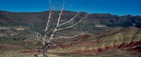
With the moon steadily rising behind us, it too was causing us to shift focus on what to photograph. Like a giant diffuse reflector, the moon projected soft filtered sunlight onto a previously dark, formless landscape. As the moonlight overwhelmed the intensity of the starlight, it removed the opportunity for crystal clear views of the Milky Way, as well as faint meteor sightings. Being photo opportunist, we used the moonlight opportunity to reveal shadow-detail  on the south face of Rainier.    

The photographer appears in the dark, like some sorcerer conjuring an intense red light before Mount Rainier and her crown of stars above.

A Peaceful Paradise Lost

There’s a tranquil feeling while in the process of taking long exposures at night; it’s normally quiet with minimal distractions to overwhelm the senses or interrupt your focus. I personally enjoy these rare opportunities of solitude, to visualize an image using a minimal—Zen like perspective.

Distractions can be disruptive during these in-the-now-moments, as when cars coming around corners with intense, high-beam headlights.  More than once, clusters of cars with high beam lights appeared… just as the moon illuminated the mountain’s reflection onto a perfectly still lake. I quickly used my hands, in an attempt to shield the lens from light flare. Finally, the cars diapered into the darkness with no approaching vehicles until dawn.

Photo-illustration of the multiple effects of light sources which can cause light pollution by unintended distraction or spill-light.

Moving above the lake to find new angles for interesting compositions, I began to notice something, which I had not noticed before.  Lights of various colors, were coming from photographers bellow me, created by their digital camera’s preview monitors and infrared sensors for auto focusing. With the low light-sensitive Nikon cameras I was using, their monitor lights appeared like a bright flare in my long exposure photos. Now, I had one more unwelcome light source to deal with, which required strategic timing in making exposures to avoid the glare. 

Again, my thoughts returned to the issues of light pollution. I remembered back home when I wanted to photograph a full-moon  at night and a neighbor’s floodlight lit up the backyard. Their floodlight forced me to find the last remaining isolated shadowed corner of the yard.

My reminiscing was cut short by a distant, but bright, pinpoint of light flashing from bellow Mount Rainier’s summit.  Flashlights from mountain climbers near Camp Muir shined bright like lighthouse beacons in the semi-darkened rocks and glacier fields. Even the faintest light can shine bright at night as documented in World War II. Warships were forbidden from having any exterior lights on at night, including a lit cigarette, otherwise they could be spotted from great distances by enemy submarines.  

Lights from mountain climbers on the approach to the summit of Mount Ranier.

Encountering the Universe’s Brilliance

The improper, overuse of outdoor lighting has erased a fundamental and connecting human experience—encountering the universe’s brilliance with its galaxies and stars shining in the night sky! Making a visual contact with our own galaxy, the Milky Way, is one of the greatest shows seen from Earth.

In less than a century of civilization’s reliance on electric technology: two-thirds of the U.S., half of Europe and a fifth of people in the world—now live where they cannot see the Milky Way with the unaided eye. You can appreciate how we lost our stellar view by seeing aerial photos taken from orbiting spacecraft and the International Space Station. These startling images taken of Earth at night, reveals a man-made galaxy of artificial light, which cancels out much of the real ones in the sky above.  

Some years back, I was a part-owner in a small recreational ranch, in Eastern Washington’s, Okanogan County. Brining friends over from Seattle, it was often nighttime when we arrived. The instant of exiting the cars, was a startling event as the Milky Way’s intensity of light overwhelmed your senses. The “ranch” was remotely located, at about 5,000 feet in the mountains, near the Canadian border and 30-miles from the closest town. Days would go by where we didn’t see a car or even hear a small airplane go overhead… it was one of the most refreshing experiences of my life, to perceive nothing except wind going through trees and seeing only starlight at night for hours at a time.

Image courtesy of NASA

 A television interview with the director of a major observatory in Southern California recounted when Los Angeles had its last electrical blackout —people were calling 911 and his observatory, reporting of strange, bright objects in the night sky. Actually what the callers were seeing for the first time, was the natural light from intensely shining stars of the Milky Way.

Image courtesy of NASA.


Besides forfeiting a life inspiring, wondrous view of the cosmos, there’s tangible losses associated with light pollution. Conservative estimates are 30 % of U.S. outdoor lighting is pointed skyward in the wrong direction, which wastes billions of dollars of electricity. The unnecessary practice of lighting clouds, burns more than 6 million tons of coal, which adds harmful greenhouse gas emissions, along with toxic chemicals into our atmosphere and water.

Further scientific studies indicate wildlife is suffering the ill effects of excessive urban lighting.  The City of Chicago has taken measures to turn off or dim its high-rise lighting to enable migrating birds to continue normal migration patterns. An increase in species of insects attracted to light, along with rodent attraction to bright city lighting is a growing concern to many scientists. 

Heavy equipment product shots never look quite this good. Scheduled improvements to the viewing area above Reflection Lake, had some equipment taking a nap, before going to work when the sun came up.

Education Is the Solution to Light Pollution

The reason light pollution has continued to multiply is, we have grown accustomed to its seemingly benign expanding presence. After all, probably no one can point to a single case of a person killed from overexposure to light pollution?  However, there is a correlation to growing health risk associated with overexposure to artificial light in the form of physical fatigue and damage to eyesight. In 2009, the American Medical Association established a policy, which supports the control of light pollution.

Municipal lighting codes are beginning to help define and eliminate unnecessary light pollution. Lighting enforcement can create a more pleasing environment, by reducing excessive urban lighting, which causes fatigue from glare and cuts down on unnecessary electric utility cost. Redirecting outdoor lighting away from the sky where it is needlessly wasted is a simple and easy solution.

Installing motion detector security lights are another efficient and productive mitigation strategy. For security purpose, a light which is triggered by motion is much more effective for crime prevention than a continuous floodlight. Motion detector lights have a clear advantage of focussing our attention onto an area where there’s a sudden change from darkness to bright-light.

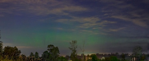
The Milky Way is what we should be able to see at night if it was not for unrestricted light-pollution. You can see the Andromeda Galaxy in the right 1/3 of the frame. Nikon D700 – Nikkor 28mm lens @ F3.5 @ 20 seconds August 11 11:48 p.m.

The encouraging news is… the key to reducing light pollution is a simple matter of basic education and action. Public awareness of over-lighting requires a minimal expenditure, which will quickly pay for itself in energy savings and perhaps return the opportunity to experience one of the greatest shows seen from earth. ~

Light pollution glossary:

Urban Sky glow: the brightening of night skies over municipal and communities. Caused primarily from collective reflected light and poorly directed light, which is pointed upward.

Light trespass: light falling or spilling into areas where it is not intended. Also know as “spill light” such municipal streetlights, which go beyond indented illumination of street signs and sidewalks and lighting residential homes.

Glare: A direct, bright or harsh light, which causes discomfort or pain. The effects of glare can be reduced or eliminated with the use of a shield or filter.

Uplight: Light angled inappropriately upward towards the sky and serving no purpose. Uplift washes out the night sky and reduces opportunities for astronomers and stargazers to enjoy the beauty of the planets, moon and stars.

Clutter: Poorly planned, confusing and unpleasant use of multiple lights usually associated with urban or retail lighting. Retail business sometime competes by using overly bright, multicolored or pulsating light

Links to articles & related resources on light pollution:

 http://www.darksky.org/assets/documents/is001.pdf

http://www.njaa.org/light.html

http://www.skymaps.com/articles/n0109.html

http://en.wikipedia.org/wiki/Light_pollution

http://ngm.nationalgeographic.com/geopedia/Light_Pollution

[contact-form][contact-field label="Name" type="name" class="GINGER_SOFATWARE_correct">/][contact-field label="Email" type="email" class="GINGER_SOFATWARE_correct">/][contact-field label="Website" class="GINGER_SOFATWARE_correct">/][contact-field label="Comment" type="textarea" class="GINGER_SOFATWARE_correct">/][/contact-form]

There’s Nothing New Under the Sun, or is There?

19 Jul

Science Tech Tablet provides periodic updates on solar activity, the essay begins after the Space Weather Prediction Center Report

Prepared jointly by the U.S. Dept. of Commerce, NOAA,
Space Weather Prediction Center and the U.S. Air Force.
Updated 2013 Jul 19 2200 UTC

Joint USAF/NOAA Solar Geophysical Activity Report and Forecast
SDF Number 200 Issued at 2200Z on 19 Jul 2013

IA.  Analysis of Solar Active Regions and Activity from 18/2100Z to
19/2100Z: Solar activity has been at very low levels for the past 24
hours. There are currently 7 numbered sunspot regions on the disk.

IB.  Solar Activity Forecast: Solar activity is likely to be low with a
slight chance for an M-class flare on days one, two, and three (20 Jul,
21 Jul, 22 Jul).

IIA.  Geophysical Activity Summary 18/2100Z to 19/2100Z: The geomagnetic
field has been at quiet to unsettled levels for the past 24 hours. Solar
wind speed, as measured by the ACE spacecraft, reached a peak speed of
674 km/s at 19/1650Z. Total IMF reached 12 nT at 18/2100Z. The maximum
southward component of Bz reached -9 nT at 19/0122Z. Electrons greater
than 2 MeV at geosynchronous orbit reached a peak level of 2710 pfu.

IIB.  Geophysical Activity Forecast: The geomagnetic field is expected
to be at unsettled to minor storm levels on day one (20 Jul), unsettled
to active levels on day two (21 Jul) and quiet to unsettled levels on
day three (22 Jul).

III.  Event probabilities 20 Jul-22 Jul
Class M    15/15/15
Class X    01/01/01
Proton     01/01/01
PCAF       green

IV.  Penticton 10.7 cm Flux
Observed           19 Jul 114
Predicted   20 Jul-22 Jul 115/115/115
90 Day Mean        19 Jul 121

V.  Geomagnetic A Indices
Observed Afr/Ap 18 Jul  016/015
Estimated Afr/Ap 19 Jul  011/014
Predicted Afr/Ap 20 Jul-22 Jul  014/020-011/015-008/010

VI.  Geomagnetic Activity Probabilities 20 Jul-22 Jul
A.  Middle Latitudes
Active                35/30/25
Minor Storm           20/10/05
Major-severe storm    05/01/01
B.  High Latitudes
Active                10/15/15
Minor Storm           25/30/30
Major-severe storm    50/40/30


 A multimedia eLearning essay by: David Johanson Vasquez © All Rights — First Addition

 Please note: This essay is a follow-up from my chronicle on solar storm effects of the 1859 Carrington Event on an industrial era society— forward to the postmodern, microelectronic world of today. To better understand the context of this article, it’s suggested you view my introduction solar storm essay found  by selecting the March 2012 archives found on left side of this page.  The National Academy of  Sciences (NAS) (funded by the U.S. Congress) produced a landmark report in 2008 entitled “Severe Space Weather Events— Societal Impacts.” It reported how people of the 21st-century depend on advance-technology systems for daily living, The National Academy of Science stated— Electric power grids, GPS navigation, air travel, financial services and emergency radio communications can all be knocked out by intense solar activity.  A century-class solar storm, the Academy warned, could cause twenty times more economic damage than Hurricane Katrina. [1] Some leading solar researchers believe we are now due for a century-class storm.                                

Photo courtesy of NASA

You’re encouraged to help make the essay interactive by entering comments or observations in the dialogue box at the end of the essay.
The essay is a work in progress, please check back as more content will be added
in the coming days.  — To see this essay in another format, please visit the site: http://www.BigPictureOne.wordpress.com
July 15, 2012 aurora borealis sighting near Everett, WA. This event was caused from an X-class solar storm, which occurred within a week of another X-class storm (X-class being the most severe classification). The 11-year solar cycle is approaching a solar maximum around 2013, this will most likely bring more intense solar storm activity.

.

Depending on your interpretation of the essay’s title, there is nothing new under the sun when it comes to our neighboring star’s behavior. Since our Sun left its infancy as a protostar over 4 billion years ago, by triggering a nuclear fusion reaction and entering a main-sequence stage, its solar mechanics have maintained relative consistent patterns. What has not remained the same is the evolution of life on Earth, in particular, our species’ development of a civilization which now is dependent on a form of energy called electricity. Our Sun is now playing a version of solar roulette with the World’s social and economic future.

The name “aurora borealis” was given by Galileo Galilei, in 1619 A.D., inspired from the Roman goddess of dawn, Aurora, and Boreas from the Greek name for north wind. First record siting was in 2600 B.C. in China. Collision between oxygen particles in Earth’s atmosphere with charged (ionized) particles released from the sun creates green and yellow luminous colors beginning at altitudes of 50 miles (80 kilometers). Blue or purplish-red is produced from nitrogen particles. The solar particles are attracted by the Earth’s northern and southern magnetic poles with curtains of light stretching east to west.

.

Reaching back only a few generations into the 20th Century, electricity was considered a luxury—today ordinary life would be impossible without it! And that’s where our beloved Sun comes into the picture, to potentially cast a shadow on our dependency of electricity. Solar storms have been a reoccurring event before time began, but they didn’t affect people outside of providing a fantastic, special effects light-show  until a critical event happened in 1859.  

In the mid 19th century, while the industrial revolution was near full development, the resource of electric power was first harnessed. Shortly after electricity was put into use for communication using telegraph technology (a 19th century equivalent of the Internet), is when the Sun revealed                                                                                                     a  shocking surprise in the most powerful solar storm ever recorded, which was known a the Carrington Event.

The year 1859 was near a peak in the Sun’s 11-year solar cycle, when the Sun’s polarity readies for reversal. Approaching  the end  sequence of this magnetic shift, brings a solar maximum , which produces violent solar flares and ejects plasma clouds outwards into space. If the flare occurs in a region opposite of Earth, a Coronal Mass Ejection (CME) may send a billion-ton radiation storm towards our planet. Fortunately, the Earth is protected by a robust atmosphere and a magnetic field surrounding the globe, which protects us from most  solar winds. However, an intense solar storm with its charged plasma cloud  can overwhelm our planet’s protective shields. When an extreme solar storm’s magnetic energy counteracts with our planet’s protective magnet field, it creates geomagnetic induced currents (GICs). GICs are massive amounts of electromagnetic energy which travel through the ground and ocean water, seeking the path of  least resistance in power lines, pipe lines and rail tracks. 

In the 1859, Carrington event, the GICs surged through the world’s emerging global communication system,known as the telegraph. So much power was generated from the solar storm entering the Earth’s atmosphere, it sent massive currents through telegraph wires, catching offices on fire, nearly electrocuting operators and  mysteriously continued sending signals with batteries completely  disconnected.     

A visual indication of the Earth’s magnetic field being overwhelmed occurs when the aurora borealis appears. If the cosmic-light-show can be seen near the tropics, it’s an indicator our planet’s magnetic fields are severely being overrun. In the extreme solar storm of 1859, the aurora borealis was seen near the equator and it was reported  people were able to read newspapers outdoors at midnight. Navigational compasses (19th century version of GPS)  throughout the world spun-out-of-control due to the flux of electromagnetic energy.

                                                                                                                                                                                                                                     
A more recent, dramatic example of a solar storm’s impact is the 1989, Quebec-Power blackout. The geomagnetic storm created was much milder than the solar maxim of the 1859, Carrington Event. However, it’s a chilling preview of what a complex, unprotected  electrical grid faces when up against the forces of super solar storm. Quebec-Power’s large transformers were fried by the GICs overloading its grid network. Electrical grids and power-lines  act like a giant antennas in pulling in the  massive flow of geomagnetic energy. In the 1989 solar storm incident, over 6 million people lost power in Eastern Canada and the U.S., with additional connecting power grids on the verge of collapsing.  Again, the powerful 1989 solar disturbance was not the 100 year super storm, but a small preview of what can if  preparations are made to protect the power grid.
`
Solar scientist are now able to put together how extreme storms follow an 11 year solar maxim cycle, like the one we’re now entering, and should peak sometime in 2013. Already this year, six major X-class solar storms, the most intense type, have occurred since January. Within one week of July, we had two of the X-class storms, with last one pointing directly at Earth. On July 13, 2012, the Washington Post’s Jason Sometime, wrote an article with his concerns on how NASA and NOAA were sending out inconsistent warnings about the solar storm from July 12.

A spectrum of telecommunication may be lost during severe solar and geomagnetic storms. Photo: David Johanson Vasquez © All Rights

`
The federal agency FEMA, appears to have learned its’ lesson from Hurricane Katrina and being proactive with a series of super solar storm scenarios. These  scenarios  illustrate the many challenges towards maintaining communication and electric power, based on the strength of the solar event. Without reliable power, food distribution will be problematic. Today we have less reliance on large warehouse  inventories and more dependenancy on — “just in time” food delivery. According to Willis Risk Solutions (industrial underwriter insurer for electric utilities) and Lloyds World Specialist Insurer (formerly LLoyds of London), there’s a global shortage of industrial large electric transformer, which now are only made in a few countries. It would take years to replace the majority of the World’s electric transformers and technically require massive amounts of electric power, which ironically, would not be available in an event of an extreme geomagnetic storm.  http://www.lloyds.com/News-and-Insight/News-and-Features/360-News/Emerging-Risk-360/Transformers-a-risk-to-keeping-the-power-on-230810
`
The companies and  the federal agencies mentioned in this essay, are overall, considered highly respected and cautious in forecasting major threats to societies and national economies. All of the mentioned government entities and scientific organizations realize it’s not a matter  if, but when will the next super solar storm be aimed and sent to Earth.
`
The good news is we can still take the necessary precautions to protect our society and economic future form this clear and present threat. Here’s a link to the 2008 National Academy of Science (funded by congress) report:  Severe Weather—Understanding Societal and Economic Impact: A Workshop Report (2008). This group meets every year to work on preventative strategies. The report contains cost-effective protection plans for electric power grids, please see link provided.        http://books.nap.edu/catalog.php?record_id=12507 
.
Second Addition: More to be added in the days ahead including…
— Update on U.S. House of Representatives and Senate sponsored  legislation for solar and geomagnetic storm preparedness.
— Electric power industry mitigation and preparedness for solar and geomagnetic storm preparedness.
`
`

Chronicles of the largest solar and geomagnetic storms in the last 500 years.

1847  — First geomagnetic storm caused by solar flare inadvertently documented with telegraph technology.  Reports were the telegraph system was sending clearer signals by disconnecting its batteries and using the geomagnetic energy from the storm.  First published affects caused from geomagnetic storm.

1859  — Becomes known as the “Carrington Event;” telegraph system becomes inoperable worldwide as reports of offices are set on fire from supercharged telegraph wire. This is the largest geomagnetic storm in 500 years. Scientist impressed with the event begin documenting future solar storm activity. The destructive power from a storm of this magnitude would devastate global power grids, satellites, computer and communication systems.

1921 — Know as the “Great Storm,” it impacted  worldwide telegraph and radio signals with total blackouts  and cables were burned beyond use. This scale of geomagnetic storm is likely to occur approximately once every 100 years.  As we approach a century mark since this type of storm took place — it’s possible another one could happen at anytime, with devastating results unless preventative measures are taken.

1989 —  Major solar flare erupts on surface of the Sun opposite of Earth; a resulting solar storm trigers a massive geomagnetic storm, which overwhelms Quebec’s power grid. As a result of the storm, six million people instantly loses power as U.S. Northeast and Midwest connecting grids come within seconds of collapse. As a result, Canadian government becomes proactive and takes effort to protect its power grid from future solar storms.

2003 — Know as the “Halloween Storms” this series of geomagnetic storms disrupted GPS, blocked High Frequency (HF) radio and triggered emergency procedures a various nuclear power plants. In Scandinavia and South Africa, section of  power grids were hit hard, many large power transformers were destroyed by the powerful geomagnetic induced currents (GICs).

Chronological  Reports and News Accounts of Solar Storms From 1859 to 2003

This is one of the most comprehensive  list of solar storm accounts on the web. The site chronicles strange solar storm happenings; such as reports in the early 1960s  with TV programs suddenly disappearing and reappearing in other regions. Other unsettling reports include the U.S. being cutoff from radio communication from the rest of the world during a geomagnetic storm. Please see link below:

http://www.solarstorms.org/SRefStorms.html

.
.

Solar Storm Acronyms and Terms

ACE — Advance Compositional Explore = NASA satellite used in detecting and monitoring potential damaging solar flares and CMEs.

AC — alternating current

BPS — bulk power system 

CME — coronal mass ejection = caused from a solar fare near the surface of the sun, which sends  a billion-ton radiation storm out into space.

EHV — extra high voltage

FERC — United States Federal Energy Regulatory Commission

GIC — geo-magnetic induced current = an extreme solar storm’s magnetic energy counteracts with our planet’s protective magnet field, creating electric current which conducts or travels through the ground or ocean water.

GMD — geo-magnetic disturbance

GAO — Government Accounting Office

GPS — global positioning system = A series of satellites positioned in an Earth, geostationary orbit for use in military and civilian navigation

NERC — North American Electric Reliability Corporation

NASA — National Aeronautics and Space Administration

NOAA — National Oceanic and Atmospheric Adminestration

POES — Polar Operational Environmental Satellite

SEP — solar energetic particle

SOHO — Solar and Heliospheric Observatory (satellite)

STDC — Solar Terrestrial Dispatch Center (Canada)

STEREO — Solar Terrestrial Relations Observatory (Satellite)

..

Sources and Links

.

NASA Resources
Illustration courtesy of NASA
A useful illustration for understanding NASA’s efforts with Heliophysics System Observatory
Detail explanation of space weather and NASA monitoring can be found at the following link:   http://www.nasa.gov/mission_pages/sunearth/spaceweather/index.html
NOAA Solar storm monitor sites:
NOAA is the nation’s official source of space weather alerts, monitoring and alerts. The following NOAA site provides realtime monitoring and forecasting of solar and geophysical events.  http://www.swpc.noaa.gov/
http://www.n3kl.org/sun/status.html

Washington Post story on conflicting NASA and NOAA solar forecast warnings for the July 12, 2012 solar storm event.
 http://www.washingtonpost.com/blogs/capital-weather-gang/post/solar-storm-incoming-federal-agencies-provide-inconsistent-confusing-information/2012/07/13/gJQAkm06hW_blog.html

NASA and NOAA sites (post warning of impending dangers to the electrical grid from solar storms producing extreme geomagnetic induce currents (GICs) on Earth). http://science.nasa.gov/science-news/science-at-nasa/2009/21jan_severespaceweather/ http://science.nasa.gov/science-news/science-at-nasa/2010/26oct_solarshield/ http://www.noaawatch.gov/themes/space.php

http://www.guardian.co.uk/science/2012/mar/18/solar-storm-flare-disruption-technology

http://www.wired.com/wiredscience/2012/07/solar-flare-cme-aurora/

http://www.usfa.fema.gov/fireservice/subjects/emr-isac/infograms/ig2012/4-12.shtm#3

My solar storm articles from February www.bigpictureone.wordpress.com  and in the March addition of  www.ScienceTechTablet.wordpress.com  present a comprehensive picture of how solar flares and solar storms originate, with the potential of producing geomagnetic storms on Earth.  If these geomagnetic storms are severe enough, they can threaten our way of life. Some strategies and common sense precautions are offered  for civic preparedness in the case of an extreme solar event.


`

Boeing’s 787 Dreamliner Historic First Flight From Paine Field, Everett, WA.

10 Apr

Multimedia essay by: David Johanson Vasquez © All Rights

My video camera kit had been prepared months in advance, ready in a moment’s notice for the first maiden flight of Boeing’s 787 Dreamliner—21st Century entry airliner.  Finally, Dave Waggoner, the director of Paine Field Airport, queued me into the date to witness an evolutionary advance in commercial aviation.

Cameras Packed And Ready To Go

My home is only a short drive from Boeing’s production facilities at Paine Field, Everett; so I was motivated to video record this “making of 21st century aviation history.”  Due to initial production delays, an entire year went by before I received reliable news of the 787-8 wide-body, long-range airliner was ready for her much-anticipated maiden flight. The 787 Dreamliner’s first flight was at 10:27 a.m. PST, December 15, 2009.

Experienced As A Boeing Scientific Photographer

The 787 first flight ,video project brought back some great memories from my former career as an aerospace photographer with the Boeing Company.  When first hired on by the iconic, aviation leader, my assignment involved providing video support for the Everett plant’s test engineering groups, who were conducting bulkhead fatigue test on airline fuselages.  In preceding years, some airlines began experiencing  inflight catastrophic failures related to metal fatigue. Tragically  the determined cause was from the age of the aircraft, specifically, stresses created when interior cabins went through an excessive number of pressurization cycles.

An event in the 1980s, of a Boeing 737 was dramatically documented as it safely landed with a massive section of the fuselage missing. The Aloha Airlines, 737 jetliner experienced a catastrophic failure due to metal fatigue. The metal fatigue issues caused from pressurization cycles on aircraft were not clearly understood, so the FAA required engineering test to research the potential safety threat.  

A series of highly documented Test were conducted over a period of months; going through thousands of pressurized cycles.  The purpose was to recreate what a jet airliner physically experiences when the cabin is repeatedly pressured and unpressurized — as in every-time an airliner takes-off, gains altitude and eventually returns for its landing. Our team of scientific photographers had series of video cameras, strategically placed within the test bulkhead, which sat shrouded inside layers of protective coatings, in a remote section of the Everett facilities. Over-pressurizing the bulkhead eventually caused the anticipated failure, announced  by a thunderous sound of cracking metal. The  bulkhead  test was well documented using various engineering test methods and imaging equipment. Valuable test data gathered was immediately analyzed, studied and put to methodical use for redesigning, engineering and manufacturing safer jet airlines.

Examining a fuselage section of the 787 which uses composite carbon fiber materials.

Boeing’s Traditional Practice Of Over-Engineering

It’s been my experience, which confirms for me, what commercial pilots and engineers claim regarding Boeing’s reputation with its conservative practice of “over-engineering” their aircraft.  Historically, an over-engineering approach has proven itself as a life saving benefit — with countless Boeing aircraft surviving horrific damage… yet, still landing safely. Documentaries on WWII aircraft feature  shot-up Boeing aircraft returning safely, is an example of over-engineering. 

For teams performing test  monitoring, with elaborate configured structures,  attached string gauges and actuators trying to force a break of an airplane part — the aerospace test may go on for days, or even months — the experience feels like sitting in bleachers for hours while watching slow-motion glacier races in progress.  All the invested resources of  time and effort, which goes into these aerospace component test,  helps to assure the flying public’s safety and the airlines performance records.

Engineers enjoy seeing how much torturous abuse their designed support systems will take before they bend, crack or break.  At the instant  a component does finally fail [normally after  far exceeding the range of what it was designed to do] you’ll hear a loud noise caused from a test-object going beyond its limit. The sound of the breaking part, ends the tension of monitoring a test for hours or days — in an instant, the team of test engineers and technicians start cheering like a goal was scored by a home team in a stadium full of their fans.

Boeing 787-8 Dreamliner taxiing for its historic, maiden flight on December 15, 2009 from Paine Field Airport, Everett, WA.

Carbon Fiber Future In Aviation

One of many significant technological improvements for the new long-range, wide-body 787 Dreamliner, is a high percentage of composite, carbon fiber materials used in its construction. The amount of composite, materials employed in today’s aircraft have substantially increased from when it was initially developed  and used in military aircraft.  I recall, how amazingly light wing spares made of carbon fiber composite materials are, when moving them under lighting setups at Boeing’s Gateway studio.  It was fascinating observing and photographing the manufacturing of composite materials, as the process involves using massive heated autoclaves to form predesigned sections for aircraft structures.

Now, remember the bulkhead test from a previous paragraph?  Carbon fiber composites eliminates the issue of metal fatigue associated with pressurizing  passenger cabin space.  Less concerns over metal fatigue allows for more pressurization  in the cabin for passenger comfort  — more importantly, the  integrated use of composite materials ensures greater safety, with substantially less risk to the structural integrity of the airliner.

Is Boeing’s Reliance On Outsourcing The Main Culprit For The 787 Dreamliner Being Grounded In A Global Lockdown?

In the past 15 years, Boeing’s upper management has broke formation from its traditional engineering leadership and replaced it by promoting executives with business and marketing backgrounds. The current Boeing regime embraces an outsourcing strategy, unfortunately, this trend of maximizing profits for shareholders has been on going with U.S. companies for the past two decades. Negative consequences of replacing an engineering management with a business one is clearly apparent in the power transmission industry — deregulation & marketing-driven-management  in the electric power industry has significantly placed this essential infrastructure at risk [overstretched power grid, vulnerable outdated high-power transformers.] Please see my multimedia essay – Will the Last People Remaining In America, Turn the Lights Back On? : https://sciencetechtablet.wordpress.com/tag/solar-storm-testimony-to-u-s-senate/    Money_int _BPP_a223

A heavy dependence  on  foreign outsourcing is sighted as a cause for unforeseen 787 production delays. Consistent, quality control monitoring becomes problematic when components are manufactured offsite, as result these issues can sometimes lead to extended,  unanticipated problems.

photo illustration Outside vendors are capable of producing equal, if not superior quality components to that of Boeing in some technical areas. In fact, there are legions of aerospace companies in the Puget Sound region, which supply critical parts to the 787 Dreamliner’s manufacturer. Some outsourcing is absolutely necessary for Boeing to compete with Airbus. The concern is outsourcing critical components in a new airplane program, which is attempting to use technology never used in a commercial airliner. It’s ironic, li-ion batteries are at the center of the 787’s grounding — lithium batteries have been a concern for over a decade to the FAA, TSA & NTSB, even leading to bans & restrictions for passenger’s to bring on commercial flights. It’s almost hubris or a form of high-risk gambling, to “initially” rely so heavily on outside vendors [GS Yuasa, the Japanese firm making the li-ion & Thales, the French corporation making the batteries’ control systems] for producing an unproven, prototype system.  L PI CRTBD BPP et99

While working as a Boeing employee in the 1990s, I recall an incident with a vendor supplying thousands of counterfeit aircraft quality fasteners made in China. Fortunately, the fiasco was caught early — but not before many hours and dollars were lost, going back to inspect wings on the production line, to remove & replace the defective fasteners. photo illustration

Unless solid metrics are emplace to assure critical standards are met for each component, it’s only a matter of time before a failure will occur. Boeing has traditionally been an aerospace company, which “over engineers” it airplanes & errors on the side of safety. Hopefully the company has maintained & continues to practice these quality assurances

Outsourcing is practical both economically and politically for companies with international sells. It’s a successful strategy Boeing has used for many years; outsourcing has proven to provide incentives for foreign airline companies to buy Boeing aircraft, in order to support their own domestic aerospace industries.     World_box_BPP_et424

The American auto manufacture Tesla, had similar “thermal runaway” issues when first using li-ion batteries to power its Roadster. Tesla Motors, benefited from its learning curve by switching to Lithium Iron Phosphate batteries, which run at cooler temperatures. The innovative auto manufacture also developed its own battery pack architecture, with proprietary liquid cooling system packs — for controlling battery cell temperatures within self-contained, metal lined enclosures.  The nontoxic, Tesla battery packs are manufactured domestically in Northern California. Perhaps Boeing should be considering manufacturing all critical systems in-house and domestically as Tesla has done.

Boeing 747 at Everett manufacturing facilities.

Boeing 747 at Everett manufacturing facilities.


L TEC ELMICROS BPP et211

Again, it’s to early to know the exact extent of the problem  with the 787’s battery systems. There’s no doubt, the issues will be isolated and corrected, as  Boeing has long history of thoroughly testing and over-engineering its aircraft systems. One thing is certain, it’s rare for Boeing to experience a new aircraft being grounded simultaneously by  Japan’s transport ministry and by the FAA.

Ultimately,  A Bright Future Awaits The 787 Dreamliner

Gaining profitable fuel savings by developing a lighter, wide-body aircraft, combined with the fuel-efficient, GE or Rolls Royce engines, produces a major advance for airliner capabilities.  The tangible benefits in comfort, interior lighting and convenience  contribute to a remarkable passenger experience.  All the evolutionary, technical advances in the Boeing 787 Dreamliner, creates a remarkable new development  for commercial aviation. ~

Future of Flight Museum - Mount Rainier & Paine Field in background Everett, WA

Future of Flight Museum –
Mount Rainier & Paine Field in background Everett, WA


Boeing 787 Dreamliner Maiden Flight – December 15, 2009 – Paine Field, Everett, WA.  Video by: David Johanson Vasquez © All Rights Reserved

The Unworldly Splendor of Oregon’s Painted Hills.

3 Apr

Photo/video and text by: David Johanson Vasquez © All Rights

The sun had just set as I arrived at my friend’s condominium on Lake Washington near Seattle.  Rick was loading camera equipment into his SUV Ford Escape, which is a gasoline-electric hybrid and incidentally one of the first American-built hybrids.

We had a long drive ahead of us and we’d be traveling all night until reaching our destination in the high desert of Central Oregon.  It was a cool, but clear, May evening, as the SUV climbed steadily up Snoqualmie pass; taking us over the Cascade Mountains and  into dryer Eastern Washington.  After a few hours of driving the glow from a near full moon was illuminating the desert sagebrush outside the town of Goldendale on the Columbia River.

Wind turbines above the Columbia River are lit by the moon.

Our adventure to John Day Fossil Beds National Monument, was planed  to coincide with a full moon to illuminate the surreal Painted Hills within the Monument.  Rick and I use digital cameras, featuring full-sized imaging sensors and fast optical lenses, which are ideal for capturing in lowlight environments.  Taking the opportunity to harness some moonlight as it rose above the Columbia Gorge, we made a stop to photograph wind turbines, which populate this section of Washington and Oregon.  The site is ideal for wind farms due to the wind tunnel conditions created by compressed airstreams forcefully moving through the constricted Gorge.   

Standing next to a colossal tower is a strange experience.  These wind catchers are the largest machines you’ll probably encounter on land and the eerie sounds produced from the massive propeller blades takes some getting use to.

Driving on the Washington side of the Columbia River and into Oregon you see legions of wind turbine sentinels, as they constantly harvest the restless winds.  It takes an hour of driving south on the highway before we no longer have towers flanking our drive. What I’m surprised not to see are other cars traveling in either direction on the highway.  The vast size of Eastern Oregon is not appreciated unless you spend some time touring in its’ large, unpopulated counties.

After traveling all night and encountering some falling snow as the hybrid SUV started ascending the road to the high desert—we finally entered into the realm of the primeval Painted Hills.  It’s totally dark now that the moon set hours earlier, so we pull into a remote area to catch a couple of hours of sleep before our video and photography expedition begins.  The John Day Fossil Bed National Monument is organized into three Units; the Painted Hills is the third Unit, which contains 3,132 acres of wildlife, plants and some unusual geology.

Over millions of years, layers of ash from nearby volcanic eruptions mixed with clay through the process of erosion to cause intense patterns of color.

The following morning was a like waking up in some eye-candy dreamland.  The colors just popped out of the scene like a TV monitor, which had been over adjusted with the saturation turned way up.  Stunned by the startling beauty, I grabbed my video camera on a tripod and began shooting panorama footage.  Ready for capturing the details of the environment; an external microphone was used to record the outburst of chattering songbirds, which had woken up to herald the beginning of a new day.  My first impression was an experience of sensory overload; it was  challenging to take in all the colors, sounds and surreal shapes of the textured topography.  What I was seeing, appeared to be out of this world —like viewing some futuristic post cards of a terraformed  Martian landscape.

What I remembered from earlier road trips to Southwest was how striking the Painted Desert in Arizona appeared but that now seemed pale in comparison to the Painted Hills.  What makes the  geology at this site so vivid with saturated color was caused by a series of volcanic  eruptions, occurring over millions of years.  The accumulation of bright  layers of ash, dust and clay mixed together from relentless years of erosion — forming intense, saturated strata of colors, layered into the hills.

What remains buried beneath the volcanic soil is a time-capsule, of preserved fossil remains from mammals and plants, which thrived  during the  Cenozoic Era – the Age of Mammal [roughly 65 million years ago.] This National Monument is a target rich environment for paleontologist studying fossils from this time period.

After I shot about an hours worth of video from the spot we had park at from the night before, it was time to scout other dramatic locations.  Not too far into our drive we spotted a family of graceful antelope, casually grazing in a large field.  Apparently, from talking with one of the NPS Rangers, this National Monument is full of indigenous wildlife including: bears, cougars and eagles.

Latter in the afternoon we stopped at the side of a gravel road to take in a stunning view of  one of the larger hills at the site.  The clouds above were opening and closing like a massive shutter on a spotlight; producing lighting effects which were irresistible.  We set up tripods along with our video and still cameras to begin shooting right away.  Shortly after, a ranger  pulled up close to the SUV and was intently watching us. Rick and I looked at each other with a shrug, thinking perhaps we had unknowingly parked in a restricted area. Eventually the ranger introduced himself, he had the impression we were part of a National Park Service video crew, which was schedule to be doing work at the Monument.  The ranger was there to lead a group of photographers into a restricted area for a guided tour, so he invited us to join in.  As it turned out, this special photography tour only takes place one weekend out of the entire year —when the John Day chaenactus (a bright yellow wild flower) begins to bloom; then as quickly as it appears—it begins to fade away.

The photographer’s tour was visually fantastic and can only be experienced under the supervision of an NPS Ranger.  The plant life is so fragile here, you’re only allowed to  walk inside a dried out creek bed while touring this area.  The Ranger was gracious enough to allow me to interview him about the site.  Wind is common and unpredictable in this high desert area, so I came prepared with a wind guard on my microphone; but I did experience a few audio dropouts,  hopefully you’ll able to hear the main message clearly enough.

http://www.youtube.com/watch?v=LMno4hbg-ZA

Later that evening we photographed the landscapes using a full moon for our lighting. I’ve never seen greater clarity of the stars and moon from this high desert environment, which created a great backdrop for an unearthly landscape. We photographed throughout the night until the light of predawn appeared.

At a little over 2,000 feet in elevation, the high desert can produce cold, bone-chilling weather and as mentioned—windy conditions.  I recommend warm clothing and gloves to help keep your hands comfortable from wind-chill.  For photography, the higher altitude is a great benefit, especially for optical clarity if your focus is on night photography of stars and landscapes.

I definitely plan to go back to the Painted Hills as soon as possible… it’s a dreamlike setting I have rarely experienced, which captivates the senses, with its splendor of stunning colors contained within an unworldly environment. ~

LINKS:

Here’s a link to National Park Service’s John Day Fossil Bed National Monument:   http://www.nps.gov/joda/index.htm

For the Archives

chronicles of the everyday

OOAworld

Travel, Art, Stories, Photos, Stories, Film, Videos, Animation, Drawings, Writing

bigpictureone

Using photos, video & words to explore the Big Picture WordPress.com site

Bucket List Publications

Indulge- Travel, Adventure, & New Experiences

Daring to Live in Love!

The Alternate Economy

WordPress.com News

The latest news on WordPress.com and the WordPress community.

Eric David Warren

Telling stories through words and images.